Skip to content
NOWCAST WXII 12 News at 11pm
Watch on Demand
Advertisement

Hurricane Nigel: Latest track, spaghetti models

Hurricane Nigel: Latest track, spaghetti models
MOUNTAIN. WXII 12 NEWS HAS YOU COVERED. KEEP UP WITH YOUR LOCAL WEATHER TEAM ACROSS THE TRIAD. FOLLOW BRIAN SLOCUM ON SOCIAL MEDIA ON 521 THIS MORNING AS WE TAKE A LOOK AT HOW THINGS ARE GOING TO SHAPE UP THIS WEEK. WE’VE GOT GOOD SUNSHINE AND HIGH TEMPERATURES. CLOSE TO 80 HUMIDITY, RELATIVELY LOW OVER THE NEXT SEVERAL DAYS. BUT BY FRIDAY, CLOUD COVER WILL START TO THICKEN UP. IT WILL START TO GET BREEZY AND COULD EVEN SEE A FEW SHOWERS DEVELOPING FOR FRIDAY EVENING AND OVER THE WEEKEND FROM A SYSTEM THAT COULD DEVELOP NEAR THE COASTLINE. COOL IN PLACE NOW UNDER A RIDGE OF HIGH PRESSURE TO WE WIDEN THE VIEW, THERE REALLY ISN’T MUCH COMING OUR WAY OUT OF THE WEST. WE COULD SEE A FEW CLOUDS DEVELOPING THIS AFTERNOON. WHAT WE’LL BE WATCHING FOR FOR LATER THIS WEEK IS AN AREA OF LOW PRESSURE TO DEVELOP SOMEWHERE OFF THE COAST AND BEGIN DRIFTING NORTHWARD AND TRYING TO BRING SOME RAIN. CHANCE BACK INTO THE AREA. THAT AREA OF INTEREST DOES HAVE A 30% OF DEVELOPING SOMETHING TROPICAL OVER THAT TIMEFRAME LATER THIS WEEK AND CLOSER TO THE WEEKEND, MORE LIKELY IT WILL HAVE SOME TROPICAL CHARACTERISTICS. IT WON’T BE A FULL TROPICAL SYSTEM IF IT DEVELOPS AT ALL. BUT ALL IT NEEDS TO DO IS BRING SOME TROPICAL RAINS AND SOME BREEZY CONDITIONS INLAND AND KEEP THINGS KIND OF SHOWERY. THIS WEEKEND. THIS IS NOT EXPECTED TO BECOME A MAJOR TROPICAL DISTURBANCE BY ANY STRETCH, BUT SOME CHARACTERISTICS WILL BE A POSSIBILITY LATER THIS WEEK. TEMPERATURES THIS MORNING NOT FEELING VERY TROPICAL, ACTUALLY FEELS VERY COMFORTABLE. WE’RE STARTING OUT ANYWHERE FROM NEAR 50 DEGREES IN THE FOOTHILLS AS WELL AS THE MOUNTAINS, 49 IN MARTINSVILLE AND SOME MID 50S OVER MUCH OF THE TRIAD AND PLENTY OF DRY AIR TO DRAW UPON IN MUCH OF THE NATION, STARTING TO REALLY AFFECT FEEL THE EFFECTS OF FALL FIRST DAY OF WHICH OFFICIALLY BEGINS ON SATURDAY. TODAY BRIGHT SUNSHINE WESTERLY BREEZE AT ABOUT FIVE HIGH TEMPERATURE AROUND 79 DEGREES LATER THIS AFTERNOON IN THE FOOTHILLS OF SURRY AND STOKES, YADKIN AND WILKES COUNTIES COULD SEE A FEW MORE AFTERNOON CLOUDS, WINDS A LITTLE MORE SOUTHWESTERLY, HIGH TEMPERATURES WILL BE IN THE MID TO UPPER 70S THIS AFTERNOON, LOOKING TOWARD THE MOUNTAINS. A BEAUTIFUL DAY YOU’LL BE IN THE 60S FOR MOST OF THE DAY. HIGH CLOSE TO 70 IN THE AFTERNOON. TAKING A CHECK ON NIGEL NORTHWEST MOVEMENT AT 13. THIS IS A CATEGORY ONE STORM THAT CONTINUES TO MOVE IN THE GENERAL DIRECTION OF BERMUDA. VERY LARGE EYE ASSOCIATED WITH THE CENTER AND THE CONVECTION IS LOOKING A LITTLE BETTER. THIS WILL LIKELY STRENGTHEN A BIT AS IT TAKES A PRETTY QUICK TURN TO THE NORTH AND EVENTUALLY OUT TO THE NORTHEAST AND THEN SHOULD KICK OUT FROM THERE INTO THE NORTH ATLANTIC WILL BE WATCHING OUR NEXT TROPICAL WAVE COMING OFF OF AFRICA. LIKELY BY WEDNESDAY. THIS HAS A 70% CHANCE OF DEVELOPING BY NEXT WEEK INTO OUR NEXT TROPICAL DEPRESSION. SO WE’LL NEED TO WATCH THAT. CLOUDS AGAIN, MAYBE A FEW SHOWERS POSSIBLE FOR HIGH SCHOOL FOOTBALL AS WE HEAD INTO THE WEEKEND. MOST OF THE LOCAL COLLEGE TEAMS ARE GOING TO BE ON THE ROAD. WINSTON-SALEM STATE AND WAKE FOREST ARE BOTH PLAYING AT HOME THIS WEEKEND. RAIN CHANCES WILL BE AROUND BREEZY IF NOT GUSTY ON THE FIRST DAY OF FALL. TH
Advertisement
Hurricane Nigel: Latest track, spaghetti models
Hurricane Nigel is the latest tropical system we're watching. Nigel became a hurricane on Monday, according to the National Hurricane Center.Here are the latest models:APP USERS: Tap here for the full experienceLATEST CONELATEST MODELSATLANTIC SATELLITEGULF SATELLITE7-DAY FORECASTLIVE RADAR More from WXIICLICK HERE for the latest forecast and videocastNorth Carolina DOT Hurricane Evacuation RoutesSupplies to help you survive a hurricaneHurricane Vocab: 12 Terms You Need To KnowHurricane Warning ChecklistHurricane Watch ChecklistTalking with Children about HurricanesTips: Pets and HurricanesHurricane Myths DispelledFrom watch to warning, know your hurricane termsIt is important to know the difference between the severity of storms during Hurricane Season.Below is an explanation so you properly plan for an emergency in the event of a natural disaster.Tropical storms and hurricanes each have two descriptors, a watch and a warning. A Watch means tropical storm or hurricane conditions are possible in the “watch area.” A watch is issued up to 48 hours in advance of the onset of tropical storm-force winds.A Warning is issued when a tropical storm or hurricane conditions are expected in the “warning area.” A Warning is issued up to 36 hours in advance of the onset of tropical storm-force winds.Hurricane preparedness activities become difficult once winds reach tropical storm-force. Watches and Warnings are issued in advance of the onset of tropical storm force winds (39-73 mph)How we rate hurricanesThe Saffir-Simpson Hurricane Wind Scale is a 1 to 5 rating based on a hurricane's sustained winds, according to the National Oceanic and Atmospheric Administration. Category 3 and above are considered major hurricanes, but precautions should still be taken for Category 1 and 2 storms. NOAA and Weather.gov put together the following information that explains how each storm category is defined and what type of damage is expected.Tropical DepressionA tropical depression is a tropical cyclone that has maximum sustained surface winds (one-minute average) of 38 mph or less.Tropical StormA tropical storm is a tropical cyclone that has maximum sustained surface winds ranging from 39-73 mph.Category 1: Sustained winds of 74-95 mphVery dangerous winds will produce some damage: Well-constructed frame homes could have damage to roof, shingles, vinyl siding and gutters. Large branches of trees will snap and shallowly rooted trees may be toppled. Extensive damage to power lines and poles likely will result in power outages that could last a few to several days.Category 2: 96-110 mphExtremely dangerous winds will cause extensive damage: Well-constructed frame homes could sustain major roof and siding damage. Many shallowly rooted trees will be snapped or uprooted and block numerous roads. Near-total power loss is expected with outages that could last from several days to weeks.Category 3: 111-129 mph (Major Hurricane)Devastating damage will occur: Well-built framed homes may incur major damage or removal of roof decking and gable ends. Many trees will be snapped or uprooted, blocking numerous roads. Electricity and water will be unavailable for several days to weeks after the storm passes.Category 4: 130-156 mph (Major Hurricane)Catastrophic damage will occur: Well-built framed homes can sustain severe damage with loss of most of the roof structure and/or some exterior walls. Most trees will be snapped or uprooted and power poles downed. Fallen trees and power poles will isolate residential areas. Power outages will last weeks to possibly months. Most of the area will be uninhabitable for weeks or months.Category 5: 157 mph or higher (Major Hurricane)Catastrophic damage will occur: A high percentage of framed homes will be destroyed, with total roof failure and wall collapse. Fallen trees and power poles will isolate residential areas. Power outages will last for weeks to possibly months. Most of the area will be uninhabitable for weeks or months.


Advertisement

Hurricane Nigel is the latest tropical system we're watching. Nigel became a hurricane on Monday, according to the National Hurricane Center.

Here are the latest models:

APP USERS: Tap here for the full experience

LATEST CONE

LATEST MODELS

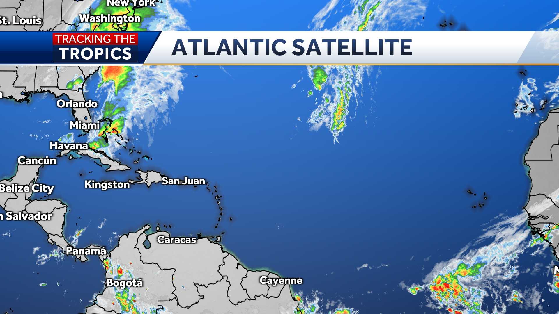
ATLANTIC SATELLITE

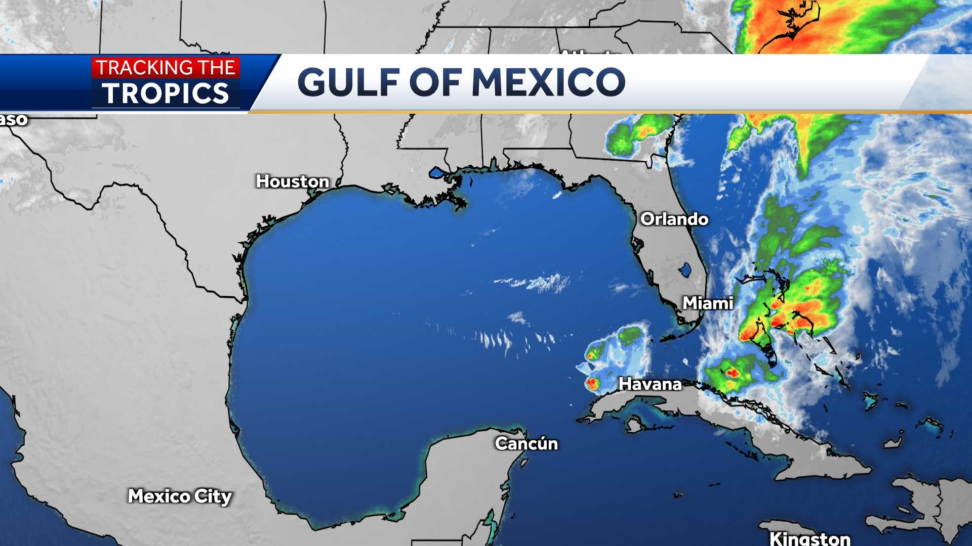
GULF SATELLITE

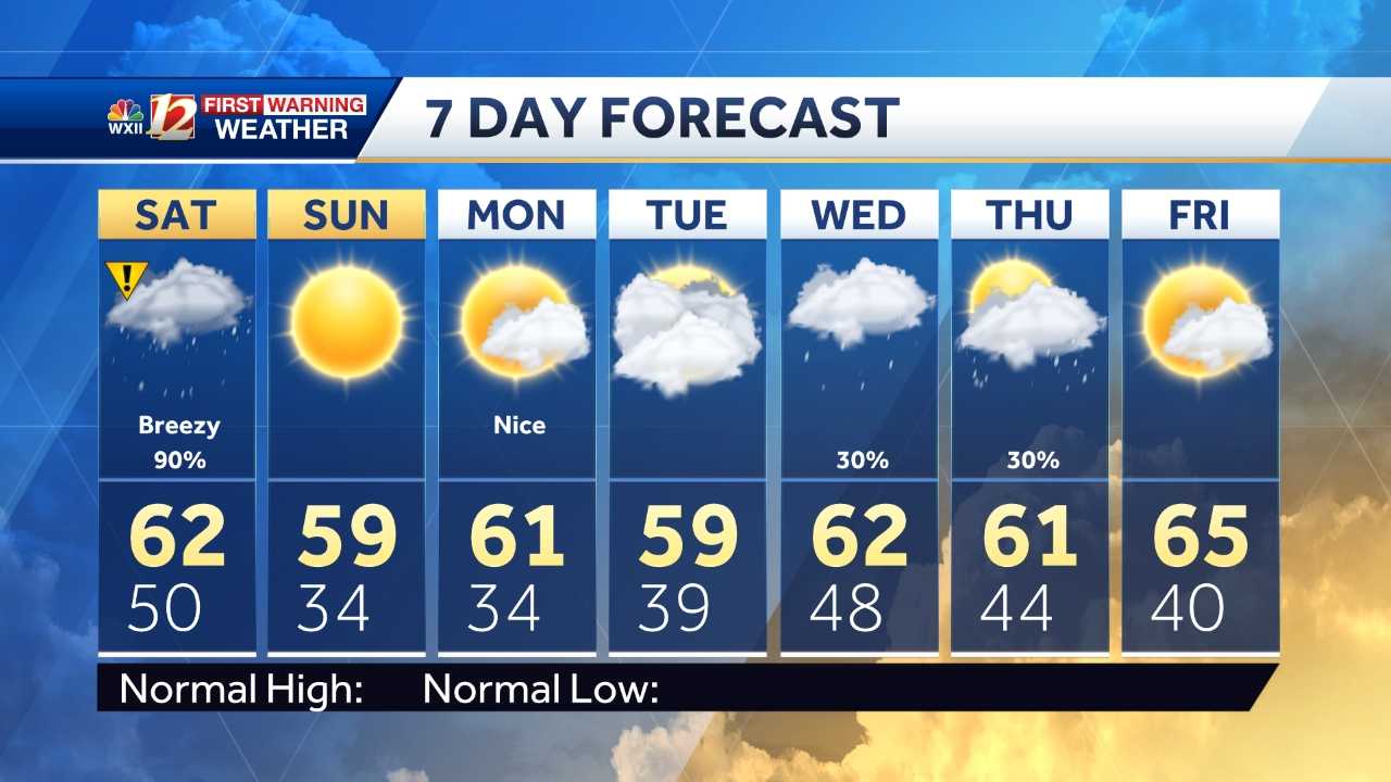
7-DAY FORECAST

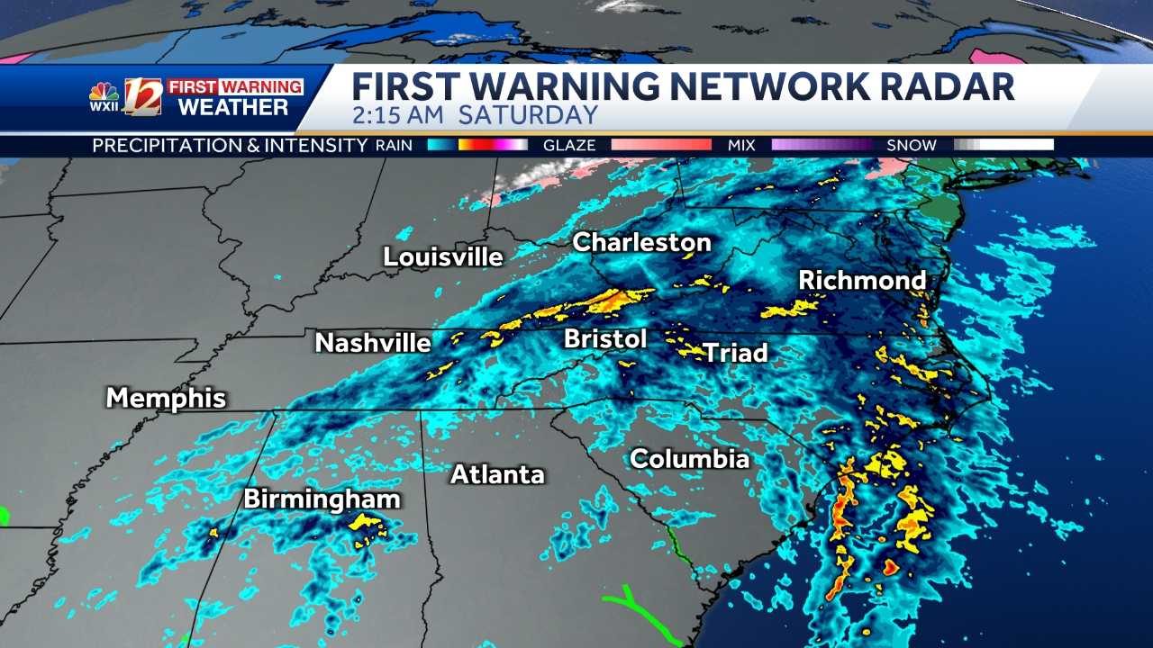
LIVE RADAR

More from WXII

From watch to warning, know your hurricane terms

It is important to know the difference between the severity of storms during Hurricane Season.

Below is an explanation so you properly plan for an emergency in the event of a natural disaster.

Tropical storms and hurricanes each have two descriptors, a watch and a warning. A Watch means tropical storm or hurricane conditions are possible in the “watch area.” A watch is issued up to 48 hours in advance of the onset of tropical storm-force winds.

A Warning is issued when a tropical storm or hurricane conditions are expected in the “warning area.” A Warning is issued up to 36 hours in advance of the onset of tropical storm-force winds.

Hurricane preparedness activities become difficult once winds reach tropical storm-force. Watches and Warnings are issued in advance of the onset of tropical storm force winds (39-73 mph)

How we rate hurricanes

The Saffir-Simpson Hurricane Wind Scale is a 1 to 5 rating based on a hurricane's sustained winds, according to the National Oceanic and Atmospheric Administration. Category 3 and above are considered major hurricanes, but precautions should still be taken for Category 1 and 2 storms. NOAA and Weather.gov put together the following information that explains how each storm category is defined and what type of damage is expected.

Tropical Depression

A tropical depression is a tropical cyclone that has maximum sustained surface winds (one-minute average) of 38 mph or less.

Tropical Storm

A tropical storm is a tropical cyclone that has maximum sustained surface winds ranging from 39-73 mph.

Category 1: Sustained winds of 74-95 mph

Very dangerous winds will produce some damage: Well-constructed frame homes could have damage to roof, shingles, vinyl siding and gutters. Large branches of trees will snap and shallowly rooted trees may be toppled. Extensive damage to power lines and poles likely will result in power outages that could last a few to several days.

Category 2: 96-110 mph

Extremely dangerous winds will cause extensive damage: Well-constructed frame homes could sustain major roof and siding damage. Many shallowly rooted trees will be snapped or uprooted and block numerous roads. Near-total power loss is expected with outages that could last from several days to weeks.

Category 3: 111-129 mph (Major Hurricane)

Devastating damage will occur: Well-built framed homes may incur major damage or removal of roof decking and gable ends. Many trees will be snapped or uprooted, blocking numerous roads. Electricity and water will be unavailable for several days to weeks after the storm passes.

Category 4: 130-156 mph (Major Hurricane)

Catastrophic damage will occur: Well-built framed homes can sustain severe damage with loss of most of the roof structure and/or some exterior walls. Most trees will be snapped or uprooted and power poles downed. Fallen trees and power poles will isolate residential areas. Power outages will last weeks to possibly months. Most of the area will be uninhabitable for weeks or months.
Category 5: 157 mph or higher (Major Hurricane)

Catastrophic damage will occur: A high percentage of framed homes will be destroyed, with total roof failure and wall collapse. Fallen trees and power poles will isolate residential areas. Power outages will last for weeks to possibly months. Most of the area will be uninhabitable for weeks or months.