Skip to content
NOWCAST WXII 12 News at 11pm
Watch on Demand
Advertisement

Tropical Storm Idalia: The latest maps, spaghetti models and paths

Tropical Storm Idalia: The latest maps, spaghetti models and paths
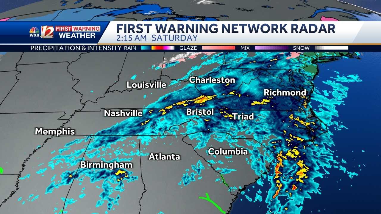
AMY. THANK YOU. 543 THIS MORNING. CHECKING THE LATEST. IF YOU’RE JUST WAKING UP THIS MORNING ON TROPICAL STORM IDALIA. THE STORM IS CENTERED MOSTLY OVER NORTH CAROLINA CENTER, THE CIRCULATION JUST SOUTH OF THE WILMINGTON AREA OF OAK ISLAND OFF BALDHEAD ISLAND. FIRST THING THIS MORNING, MOST OF THE RAIN IS NORTH AND EAST OF THERE. WE’VE GOT SOME GOOD BANDS OF HEAVY RAIN JUST INUNDATING THE COASTLINE AND SOME OF THE BARRIER ISLANDS NEAR CAPE HATTERAS, NEAR OCRACOKE ISLAND. THESE OCCASIONAL BAND BRINGING SQUALLY WEATHER AND A CHANCE THAT EMBEDDED IN THERE WE COULD SEE A WATERSPOUT OR EVEN A TORNADO. HAVEN’T HAD A TORNADO WARNING IN A LITTLE WHILE, BUT THERE WERE SEVERAL IN THE EVENING AND A FEW IN THE OVERNIGHT HOURS. RAIN HAS MADE IT ALL THE WAY UP THE COAST TO THE OUTER BANKS, TOO, FROM KERALA DOWN TO NAGS HEAD. WE’VE GOT SOME VERY WET WEATHER THERE AS WELL. THE WIND GUSTS HAVE ACTUALLY BEEN MANAGEABLE AS OUR CHRIS PETERSON HAS BEEN TELLING US ALL MORNING LONG. OCCASIONALLY WITH THESE HEAVY SQUALLS, YOU DO GET A TROPICAL STORM FORCE, WIND GUSTS IN EXCESS OF 39 OR 40MPH SUSTAINED GUSTS OR SOME OF THE GUSTS NEAR BUXTON HAVE BEEN WELL INTO THE 30S. THIS MORNING AT OREGON INLET A SHORT TIME AGO, WE’VE SEEN GUSTS UP AROUND 47MPH. SO EVEN FAR AWAY FROM THE CIRCULATION OF THIS STORM, WE HAVE SOME HEALTHY WIND GUSTS IN THE AREA. THE RAIN IS STARTING TO EASE INTO THE I 95 CORRIDOR AND WIND DOWN WEST OF THERE. MEASURABLE RAIN WAS BY FAR AND AWAY HIGHEST JUST INLAND FOLLOWING THE CENTER OF THE STORM WHERE YOU SEE THE BRIGHTER COLORS, YOU’RE LOOKING AT ANYWHERE FROM 3 TO 8IN OF RAIN IN THAT ENTIRE REGION WITH SOME HEAVIER POCKETS THAT MAY EXCEED DOUBLE DIGITS, ESPECIALLY REALLY IN THE FAYETTEVILLE AREA AND POINTS EAST AS YOU GET TOWARD THE COASTLINE. SO WE LOOK AT THE TRACK FOR THE REST OF TODAY. IT’S EXPECTED TO TAKE MORE OF AN EASTERLY TRACK AS WE GO THROUGH THE AFTERNOON AND EVENING AND MOVE AWAY FROM SHORE HERE NEAR BERMUDA. IT’S EXPECTED TO SIT AROUND FOR A WHILE, THEN EVENTUALLY KICK OUT. IT MAY ACTUALLY GO THROUGH BERMUDA, BUT THE STRENGTH IS NOT GOING TO CHANGE ALL THAT MUCH IN THE COMING DAYS, LIKELY REMAINING A TROPICAL STORM MOVING FORWARD. IF YOU HAVE BEACH PLANS, LET ME SAY THIS OUT OF THE GATE, THEY JUST HAD A TROPICAL SYSTEM MOVE THROUGH. AND EVEN THOUGH THE WEATHER LOOKS BEAUTIFUL, IF YOU’VE GOT A RENTAL PROPERTY, YOU’RE GOING TO CALL AND CHECK AND SEE WHAT THE SITUATION IS THERE BEFORE YOU GO. IF YOU CAN GET THERE, THAT’S GREAT. WE HAVE SOME BEAUTIFUL WEATHER IN THE FORECAST. TEMPERATURES IN THE OUTER BANKS WILL BE IN THE 70S AS EARLY AS TOMORROW WITH THE SUN COMING OUT, PERHAPS A LINGERING SHOWER. CRYSTAL COAST FORECAST FROM ATLANTIC BEACH TO SALTER PATH WILL BE IN THE LOW TO MID 80S AND GOOD SUNSHINE AT THE SOUTHERN BEACHES AS WELL. TEMPERATURES A LITTLE WARMER IN THE BACK END OF LABOR DAY WEEKEND AND THEY WILL BE WARMER HERE, TOO, WITH TEMPERATURES GETTING INTO THE UPPER 80S AND INTO THE 90S. TEMPS THIS MORNING HERE LOCALLY AS CLOUDS ARE CLEARING FROM WEST TO EAST ARE FALLING INTO THE 50S. THERE’S QUITE A BIT OF DRY AIR CHASING THE STORM OUT, BUT WE HAVE TEMPERATURES IN THE MID TO UPPER 60S AND WE’LL HAVE HIGHS IN THE UPPER 70S THIS AFTERNOON. THE BREEZE WILL BE PERSISTENT, WILL BE GUSTY EAST IN THE MORNING AND THEN START TO WIND DOWN, GUST TO 30 EARLY. THEN I THINK PEAK GUSTS GET BACK DOWN INTO THE 20S AND TEENS AS GOOD SUNSHINE THIS AFTERNOON WITH HIGHS IN THE UPPER 70S. ALSO UPPER 70S LESS HUMID IN THE FOOTHILLS AND LOWER 70S FOR MANY OF OUR MOUNTAIN CONDITIONS. THIS IS THE BEGINNING OF A BEAUTIFUL STRETCH OF WEATHER THAT WILL LINGER INTO THE WEEKEND. HIGHS CLOSE TO 80 FRIDAY AND SATURDAY. IT WILL GET A LITTLE WARMER ON THE BACK HALF OF THE HOLIDAY WEEKEND AND WE ARE DRY FOR THE
Advertisement
Tropical Storm Idalia: The latest maps, spaghetti models and paths
Idalia has weakened to a tropical storm after roaring into Florida's Big Bend region as a powerful hurricane. It will now track through the Carolinas. Tropical storm warnings have been issued for the entire North Carolina coast.►Download the Very Local app for updates on the coming storm Please check back frequently as the WXII First Warning Weather Team will provide updates as needed.► APP USERS: Tap here for the full experienceLATEST CONELATEST MODELSATLANTIC SATELLITEGULF SATELLITE7-DAY FORECASTLIVE RADAR More from WXIICLICK HERE for the latest forecast and videocastNorth Carolina DOT Hurricane Evacuation RoutesSupplies to help you survive a hurricaneHurricane Vocab: 12 Terms You Need To KnowHurricane Warning ChecklistHurricane Watch ChecklistTalking with Children about HurricanesTips: Pets and HurricanesHurricane Myths DispelledFrom watch to warning, know your hurricane termsIt is important to know the difference between the severity of storms during Hurricane Season.Below is an explanation so you properly plan for an emergency in the event of a natural disaster.Tropical storms and hurricanes each have two descriptors, a watch and a warning. A Watch means tropical storm or hurricane conditions are possible in the “watch area.” A watch is issued up to 48 hours in advance of the onset of tropical storm-force winds.► Keep up with the latest news and weather by downloading the WXII app here. A Warning is issued when a tropical storm or hurricane conditions are expected in the “warning area.” A Warning is issued up to 36 hours in advance of the onset of tropical storm-force winds.Hurricane preparedness activities become difficult once winds reach tropical storm-force. Watches and Warnings are issued in advance of the onset of tropical storm force winds (39-73 mph)How we rate hurricanesThe Saffir-Simpson Hurricane Wind Scale is a 1 to 5 rating based on a hurricane's sustained winds, according to the National Oceanic and Atmospheric Administration. Category 3 and above are considered major hurricanes, but precautions should still be taken for Category 1 and 2 storms. NOAA and Weather.gov put together the following information that explains how each storm category is defined and what type of damage is expected.Tropical DepressionA tropical depression is a tropical cyclone that has maximum sustained surface winds (one-minute average) of 38 mph or less.Tropical StormA tropical storm is a tropical cyclone that has maximum sustained surface winds ranging from 39-73 mph.Category 1: Sustained winds of 74-95 mphVery dangerous winds will produce some damage: Well-constructed frame homes could have damage to roof, shingles, vinyl siding and gutters. Large branches of trees will snap and shallowly rooted trees may be toppled. Extensive damage to power lines and poles likely will result in power outages that could last a few to several days.Category 2: 96-110 mphExtremely dangerous winds will cause extensive damage: Well-constructed frame homes could sustain major roof and siding damage. Many shallowly rooted trees will be snapped or uprooted and block numerous roads. Near-total power loss is expected with outages that could last from several days to weeks.Category 3: 111-129 mph (Major Hurricane)Devastating damage will occur: Well-built framed homes may incur major damage or removal of roof decking and gable ends. Many trees will be snapped or uprooted, blocking numerous roads. Electricity and water will be unavailable for several days to weeks after the storm passes.Category 4: 130-156 mph (Major Hurricane)Catastrophic damage will occur: Well-built framed homes can sustain severe damage with loss of most of the roof structure and/or some exterior walls. Most trees will be snapped or uprooted and power poles downed. Fallen trees and power poles will isolate residential areas. Power outages will last weeks to possibly months. Most of the area will be uninhabitable for weeks or months.Category 5: 157 mph or higher (Major Hurricane)Catastrophic damage will occur: A high percentage of framed homes will be destroyed, with total roof failure and wall collapse. Fallen trees and power poles will isolate residential areas. Power outages will last for weeks to possibly months. Most of the area will be uninhabitable for weeks or months.

Advertisement

Idalia has weakened to a tropical storm after roaring into Florida's Big Bend region as a powerful hurricane. It will now track through the Carolinas.

Tropical storm warnings have been issued for the entire North Carolina coast.

►Download the Very Local app for updates on the coming storm

Please check back frequently as the WXII First Warning Weather Team will provide updates as needed.

► APP USERS: Tap here for the full experience

LATEST CONE

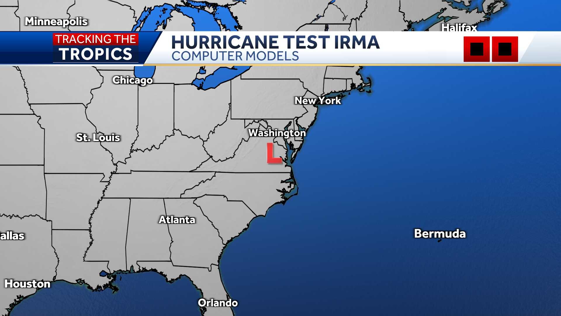
LATEST MODELS

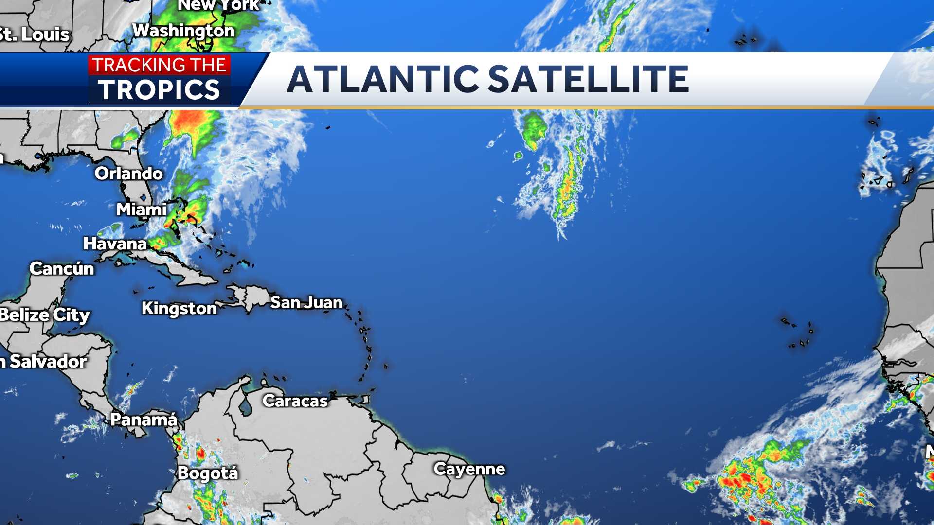
ATLANTIC SATELLITE

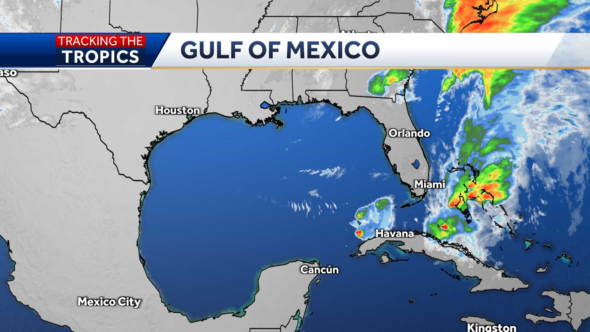
GULF SATELLITE

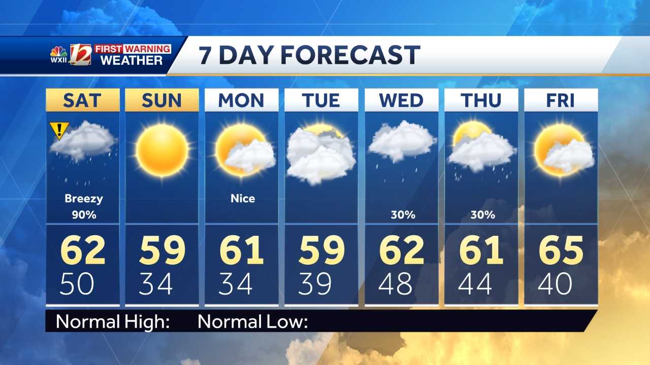
7-DAY FORECAST

LIVE RADAR

More from WXII

From watch to warning, know your hurricane terms

It is important to know the difference between the severity of storms during Hurricane Season.

Below is an explanation so you properly plan for an emergency in the event of a natural disaster.

Tropical storms and hurricanes each have two descriptors, a watch and a warning. A Watch means tropical storm or hurricane conditions are possible in the “watch area.” A watch is issued up to 48 hours in advance of the onset of tropical storm-force winds.

Keep up with the latest news and weather by downloading the WXII app here.

A Warning is issued when a tropical storm or hurricane conditions are expected in the “warning area.” A Warning is issued up to 36 hours in advance of the onset of tropical storm-force winds.

Hurricane preparedness activities become difficult once winds reach tropical storm-force. Watches and Warnings are issued in advance of the onset of tropical storm force winds (39-73 mph)

How we rate hurricanes

The Saffir-Simpson Hurricane Wind Scale is a 1 to 5 rating based on a hurricane's sustained winds, according to the National Oceanic and Atmospheric Administration. Category 3 and above are considered major hurricanes, but precautions should still be taken for Category 1 and 2 storms. NOAA and Weather.gov put together the following information that explains how each storm category is defined and what type of damage is expected.

Tropical Depression

A tropical depression is a tropical cyclone that has maximum sustained surface winds (one-minute average) of 38 mph or less.

Tropical Storm

A tropical storm is a tropical cyclone that has maximum sustained surface winds ranging from 39-73 mph.

Category 1: Sustained winds of 74-95 mph

Very dangerous winds will produce some damage: Well-constructed frame homes could have damage to roof, shingles, vinyl siding and gutters. Large branches of trees will snap and shallowly rooted trees may be toppled. Extensive damage to power lines and poles likely will result in power outages that could last a few to several days.

Category 2: 96-110 mph

Extremely dangerous winds will cause extensive damage: Well-constructed frame homes could sustain major roof and siding damage. Many shallowly rooted trees will be snapped or uprooted and block numerous roads. Near-total power loss is expected with outages that could last from several days to weeks.

Category 3: 111-129 mph (Major Hurricane)

Devastating damage will occur: Well-built framed homes may incur major damage or removal of roof decking and gable ends. Many trees will be snapped or uprooted, blocking numerous roads. Electricity and water will be unavailable for several days to weeks after the storm passes.

Category 4: 130-156 mph (Major Hurricane)

Catastrophic damage will occur: Well-built framed homes can sustain severe damage with loss of most of the roof structure and/or some exterior walls. Most trees will be snapped or uprooted and power poles downed. Fallen trees and power poles will isolate residential areas. Power outages will last weeks to possibly months. Most of the area will be uninhabitable for weeks or months.
Category 5: 157 mph or higher (Major Hurricane)

Catastrophic damage will occur: A high percentage of framed homes will be destroyed, with total roof failure and wall collapse. Fallen trees and power poles will isolate residential areas. Power outages will last for weeks to possibly months. Most of the area will be uninhabitable for weeks or months.